Bailey’s Crossroads


Bailey’s Crossroads Land Use Study
(use scroll bar on right side of this window to read description)
LOCATION: Fairfax County, Virginia
CLIENT: Fairfax County, Virginia
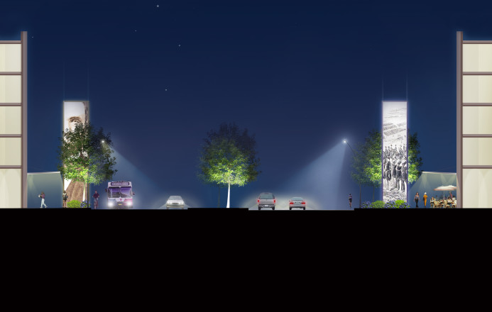
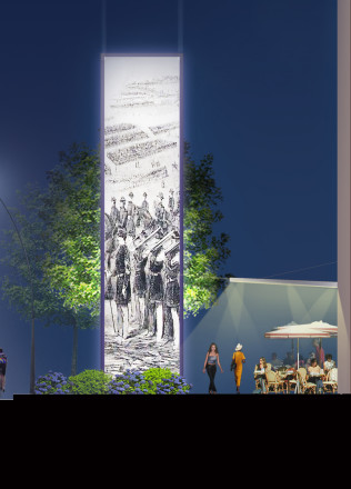
At the time of the U.S. Civil War, this was a country crossroads, where Leesburg Pike meets Columbia Pike, on a broad flat plain just outside the former 1846 boundary line of Washington, D.C. In the autumn of 1861, following the harsh summer defeat of the Union at the First Battle of Manassas (Bull Run), the Union Army selected Bailey’s Crossroads as a site for Abraham Lincoln to address one of the largest assemblages of U.S. troops in Civil War history with a morale-boosting speech.
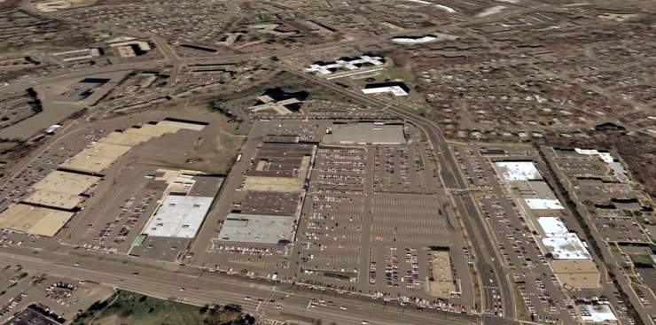
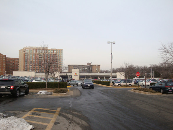
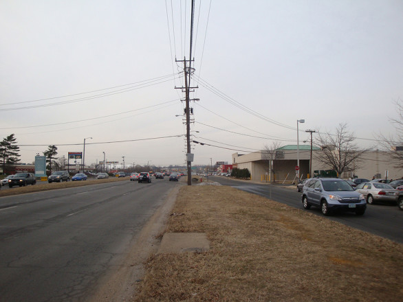
A century and a half later, the significance of the site has become visually lost, engulfed in low-rise bland suburban development, covered with asphalt and aging commercial strip malls. There is an outdated mall, a hodgepodge of offices and residential towers, surrounded by single family homes. The roadways overwhelm the site. It is a hostile pedestrian area, with few sidewalks or clear pedestrian crossings.
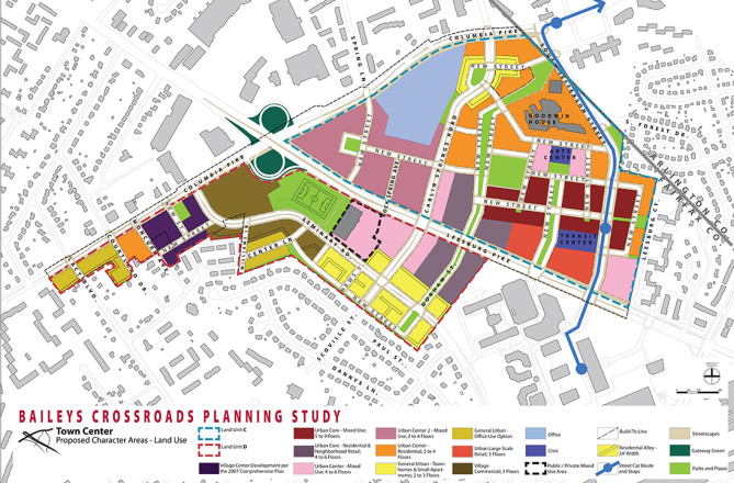
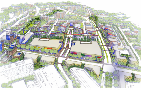
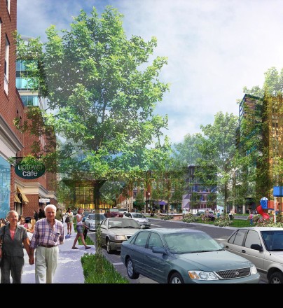
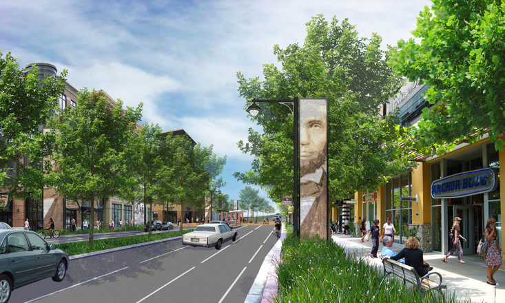
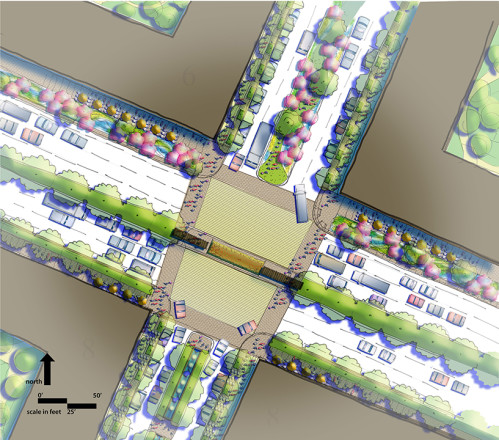
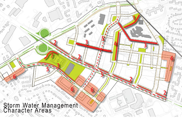
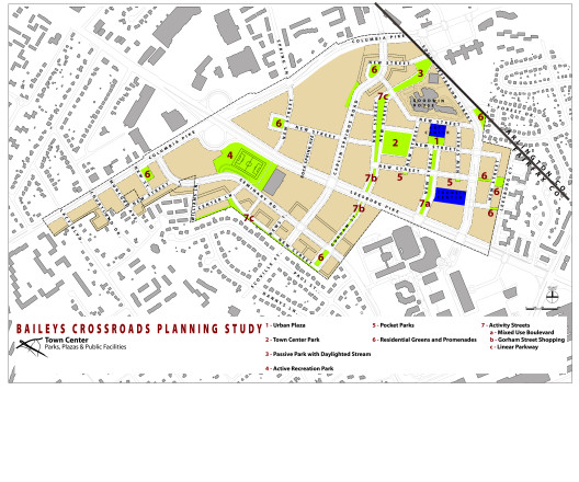
Ed Hamm worked closely with Rummel, Klepper + Kahl (RK+K) Engineers and Vantage Point Development Consultants on an intensive study to investigate the potential for a mixed-use redevelopment of the Bailey’s Crossroads area, encompassing multiple sites. Ed helped evaluate connections to the low-rise adjacent community neighborhoods and proposed alternative development scenarios regarding scale, intensity, pedestrian movement, use and form of future redevelopment. Strategies were used to incorporate a connected street grid with linear green spaces, civic, recreation, mixed use and residential areas. There was the potential to create a major pedestrian spine to give extra character to the neighborhood. A proposed series of pylons, with graphic images of Abraham Lincoln and the marshalling of U.S. troops gave a strong sense of identity.
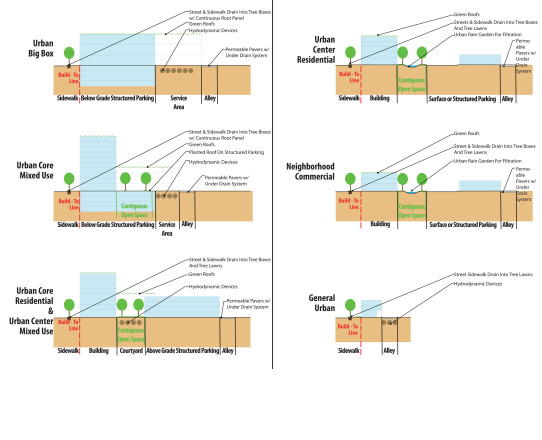
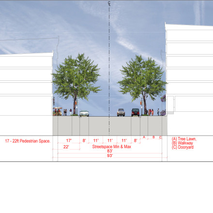
Ed’s ability to work hand-in-hand with a complex team to analyze the capacity of the site gave a greater level of confidence to the client. His visual presentations are not just eyewash, but true representations that capture the proposed future qualities. The stakeholders could see the impact of project market-based growth scenarios on road widths, sidewalks, building heights, building walls, commercial frontage, parking types and placement. This entire series of criteria became the zoning standards for redevelopment.
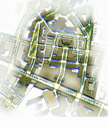
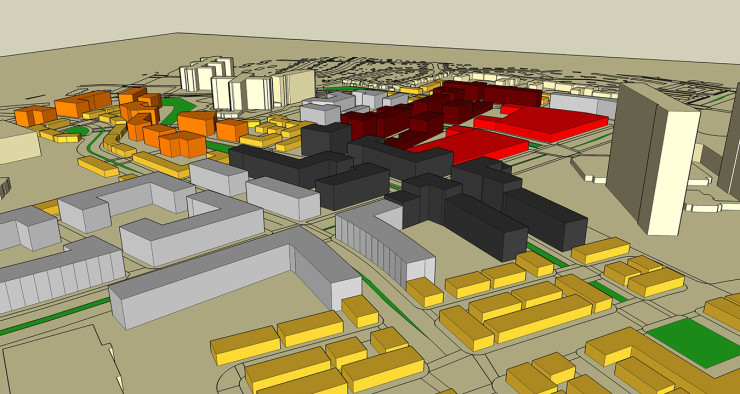
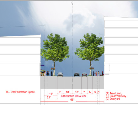
The proposals of uses, density, and building height were carefully projected, modeled and evaluated according to infrastructure and urban design constraints with Ed Hamm in the technical lead. Using two different concepts, the team explored a streetcar-based transit-oriented development with high-density uses clustered around transit stops, and an alternate town center concept in which density was more evenly distributed throughout the area. Both concepts provided a model approach for retaining the existing big box retail within a more urban context, locating the largest retailers in the upper floors, above smaller, street-friendly retail uses. The scale and width of road lanes and the width of space between roadways and street walls were carefully designed to meet pedestrian needs and the required capacity for transportation. Street widths, building footprints and heights, building massing, open space systems, were all carefully calculated in 3D models and illustrated to give true representation of the redevelopment opportunities.
The study was subsequently approved by the Fairfax County Board of Supervisors and incorporated into the County’s Comprehensive Plan. The design constraints used to test the alternatives became the prescriptive standards for use by the county and development community to guide the making of the future Bailey’s Crossroads Community. This project was completed while Ed was an associate prinicipal at Rhodeside and Harwell.